A serious adventure-sport challenge
The Druk Path Run — the four-day traverse run end-to-end in a single day, in reverse direction from Thimphu to Paro.
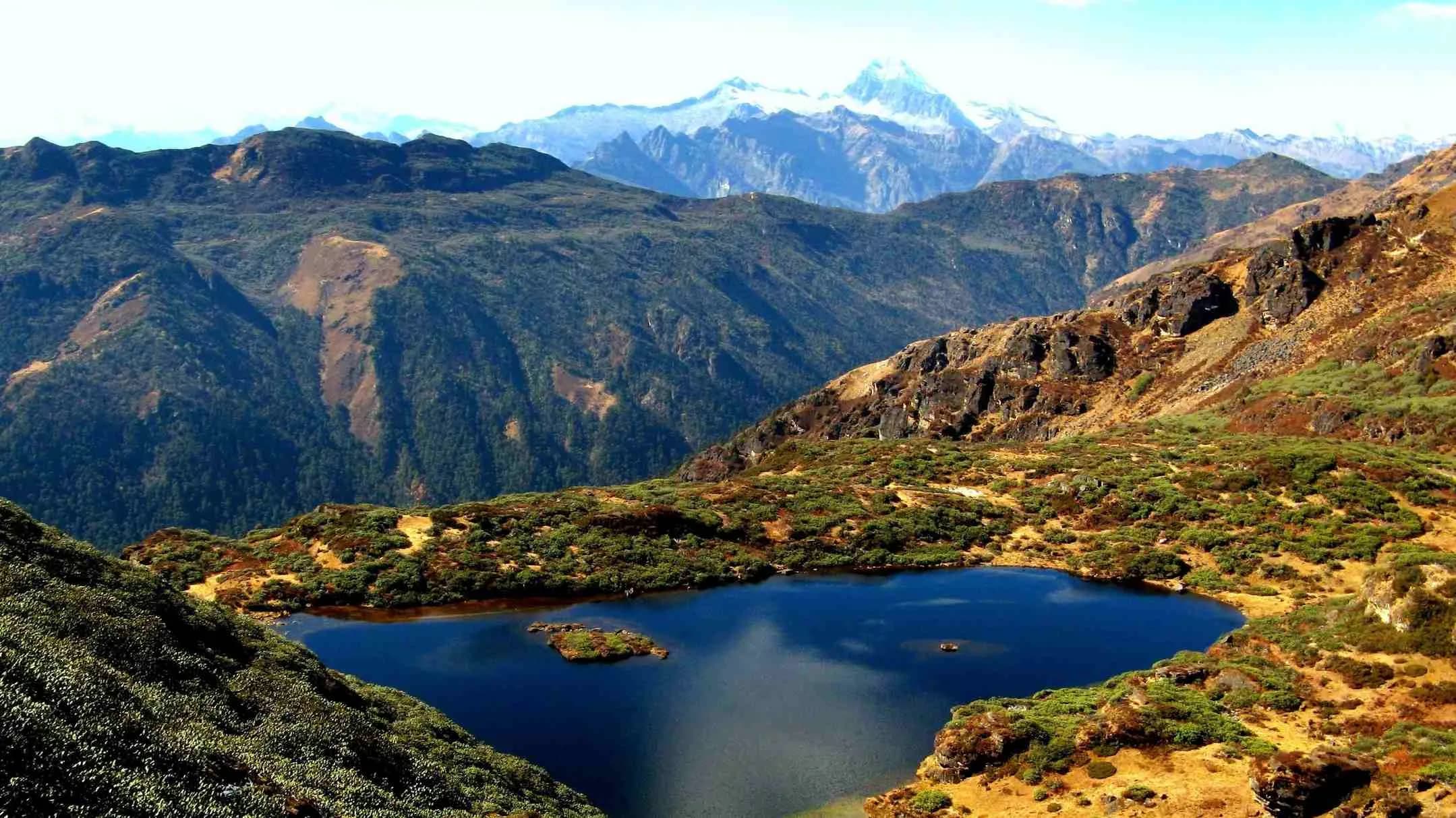
The standard Druk Path Trek runs four walking days from the Ta Dzong above Paro to Motithang on the western edge of Thimphu. The Druk Path Run is the same 60-km route — Jele Dzong, the Jimilang Tsho lake, the Janey Tsho passage, the Phajoding ascent — compressed into a single day, and run in the reverse direction: Motithang to Paro, climbing first while legs are fresh, descending into the Paro valley at the finish. The route has been completed in this form by our operator team multiple times and is, to our knowledge, the only guided expression of the Druk Path as an adventure-sport day.
Also known as The Drukpath Run · Druk Path Single Day · Druk Path Ultra
- Duration
- 1 day
- Max altitude
- 4,200 m
- Difficulty
- expedition
- Distance
- 60 km
- Region
- Thimphu, Paro
- Trailhead
- Motithang, Thimphu (2,400 m) — the trail-end of the standard Druk Path Trek, doubled here as the start of the Run
- Trail end
- Ta Dzong, Paro (2,500 m) — the old watchtower dzong above the principal Paro valley, now housing the National Museum of Bhutan
- Best months
- May · June · October · November
- Walk type
- hike
The proposition
Bhutan has a thin but distinctive adventure-sport register — the country's high-altitude trails are extensively documented but rarely run end-to-end in a single push. The Druk Path Run is the country's most-accessible serious mountain ultra: a 60-km traverse from the western edge of Thimphu to the head of the Paro valley, with approximately 2,000 metres of cumulative climbing and a maximum altitude of 4,200 metres on the ridge above Phajoding. Serious athletes complete the route in 7-10 hours — what a standard trekker takes four days to see — at the cadence of a long mountain race. The reverse direction matters: the run climbs first, while the legs are fresh, then descends into the Paro valley at the finish.
The route, in single-day form
The line is identical to the standard Druk Path Trek; the direction is reversed. The opening climb from Motithang (2,400m) gains 1,200 metres to Phajoding monastery (3,640m) over approximately 4 km of steep switchback trail — typically the first 1.5 hours of the run, taken while the legs are fresh. The high passage continues climbing from Phajoding to the ridge above Phajoding (4,200m, the day's high point) at around the 3-hour mark, then descends to the Simkota Tsho camp area shortly after. The ridge traverse runs across the high country past Janey Tsho and Jimilang Tsho (3,870m), the principal mid-route aid station, across the Jangchulakha meadow to Jele Dzong (3,480m) — typically 5-6 hours total. The final descent from Jele Dzong drops 1,000 metres through pine and rhododendron forest to the Ta Dzong above Paro (2,500m) — fast running, technical in places, around 7-10 hours total for a serious athlete.
Who this is for, and who it isn't
The realistic candidate has completed prior mountain ultras of at least 50 km with substantial vertical (3,000+ metres ascent), has trekking or running experience above 4,000 metres, and treats altitude with the respect it deserves. The route is not for runners new to ultra-distance; it is not for runners without prior altitude exposure; and it is not for runners who require crowd support, course marshals at every kilometre, or aid stations at 5-km intervals (the route's support is intentionally minimal — pre-positioned aid at Phajoding/Simkota Tsho, Jimilang Tsho, and Jele Dzong only). We position the Druk Path Run as a single-cohort, single-day product — small groups of two to four runners with full support crew, dedicated trek leader, vehicle pickup at the Ta Dzong above Paro, and an evacuation plan known and rehearsed by the team.
Day by day
- Day 1
The single-day push — Motithang to Ta Dzong (Thimphu to Paro)
4,200 m · 60 km · 8 h walking
Daylight start at Motithang on the western edge of Thimphu (06:00 typical departure). The opening climb takes the runner 1,200 metres up to Phajoding monastery (3,640m) in the first 1.5 hours, then continues climbing to the ridge above Phajoding (4,200m, the day's high point) at around the 3-hour mark. Descent to the Simkota Tsho camp area shortly after — brief aid station. Onward across the high country past Janey Tsho to Aid Station 2 at Jimilang Tsho (3,870m) at approximately 4-5 hours — the run's principal mid-day refuel with a 15-20 minute structured rest. The Jangchulakha meadow traverse to Aid Station 3 at Jele Dzong (3,480m) at around 5-6 hours. Final descent through pine and rhododendron forest to the Ta Dzong above Paro (2,500m) — typically 7-10 hours of total elapsed time for a serious athlete. Our operator team's fastest internal completion stands at 7 hours; elite mountain-ultra runners are likely capable of substantially faster times.
Before you go
- Season
- Four windows: late May, June (pre-monsoon shoulder), October, and November (post-monsoon shoulder). May-June catches the spring rhododendron in bloom on the lower trail and the post-winter clear Himalayan visibility from the ridge. October-November catches the autumn clear-sky window with the most-stable conditions across the high passages. July-September is monsoon (the meadow trail can be very wet, the high ridge cloud-bound); December-April the upper ridge carries snow that makes the high passages unsafe for a single-day push. We hold a limited number of departures per window; book 9-12 months in advance.
- Fitness and the prior-experience requirement
- We require a serious prior mountain-ultra record before accepting a Druk Path Run booking. Minimum: completion of a 50+ km mountain ultra with 3,000+ metres of vertical ascent within the previous two years; demonstrated time above 4,000 metres (any trek, climb, or run); a recent VO2max-tested aerobic-base assessment. We discuss the booking with each runner directly; not every booking is accepted. The honest position is that a poorly-prepared runner on the Druk Path Run is a serious safety risk to themselves and to the support team.
- Support and the safety architecture
- Three pre-positioned aid stations (Simkota Tsho, Jimilang Tsho, Jele Dzong — in running order) staffed by our trek crew, carrying food, fluids, dry kit, and emergency communication. Vehicle pickup at the Ta Dzong above Paro from approximately the 6-hour mark; the support crew tracks runner positions via GPS. Evacuation plan: early-route bail to Phajoding (the first aid point, 4 km from Motithang, vehicle-accessible from Thimphu) if a runner cannot continue past the opening climb; helicopter evacuation from the Jimilang Tsho ridge if required (weather-dependent). Two trek leaders accompany the runners on the trail; one paces, one carries the safety kit and the satellite communicator.
- Pre-acclimatisation
- The Druk Path Run is preceded by a minimum 5-day pre-acclimatisation programme in Paro and Bumthang. Days 1-3 in Paro at 2,200m with light morning runs; Day 4 a half-day at Jele Dzong (3,480m); Day 5 a half-day at the Bumthang valleys at 2,600m to test pace at moderate altitude; the run on Day 6 or 7 depending on weather window. Without this acclimatisation profile, altitude-related withdrawal is the most-likely failure mode on race day.
- Cost framing
- The Druk Path Run is positioned at our Signature tier — a small-group product (2-4 runners maximum), high-touch support crew, dedicated trek leaders, the full pre-acclimatisation programme, and the single-day attempt itself. Premium pricing reflects the operational depth required. Begin a proposal through our concierge for a precise quote against your dates and runner profile.
Monuments on the route
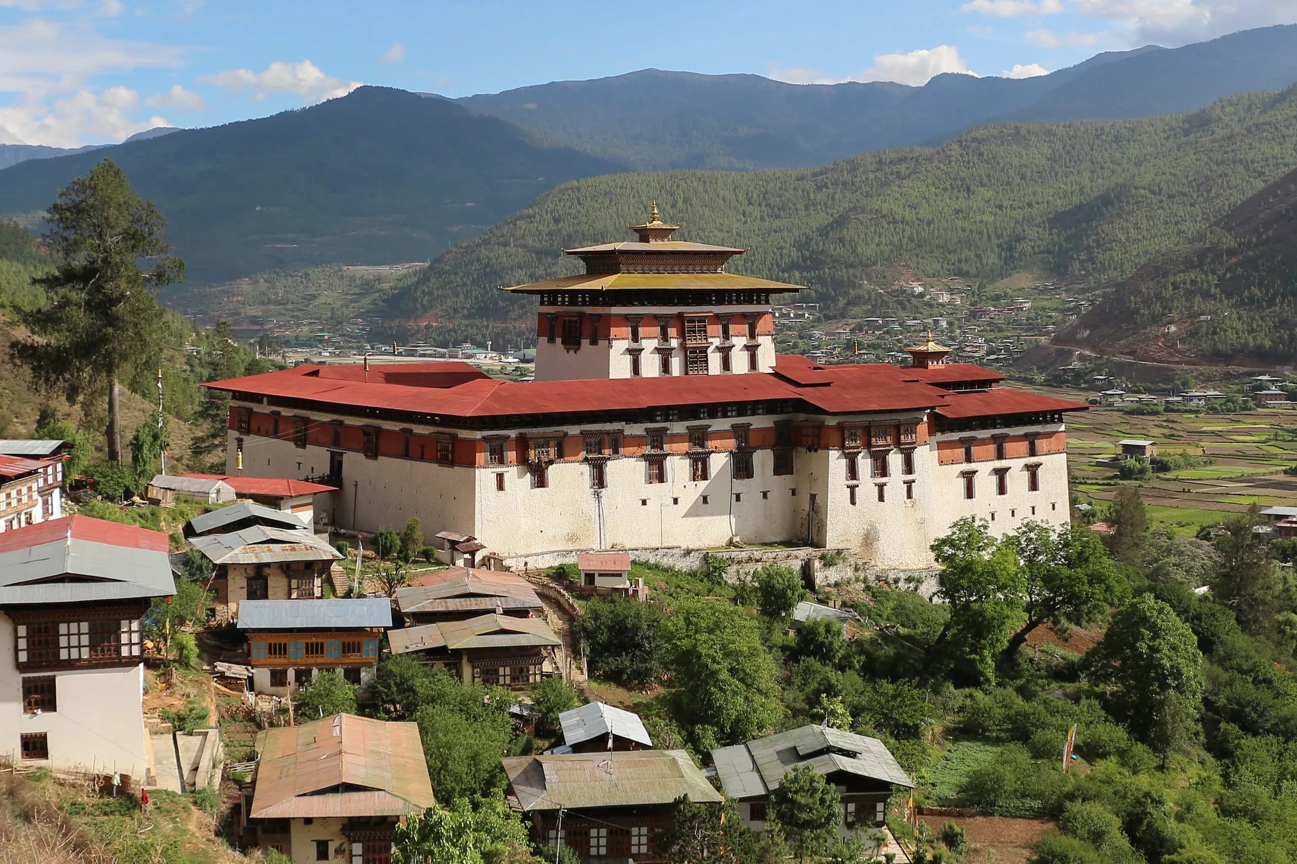 MonumentRinpung Dzong — 'the fortress on a heap of jewels,' the architectural masterpiece of the Paro valley.Rinpung Dzong (Paro Dzong) — the heap of jewels, founded 1644. History, architecture, visiting, the Paro Tshechu venue.
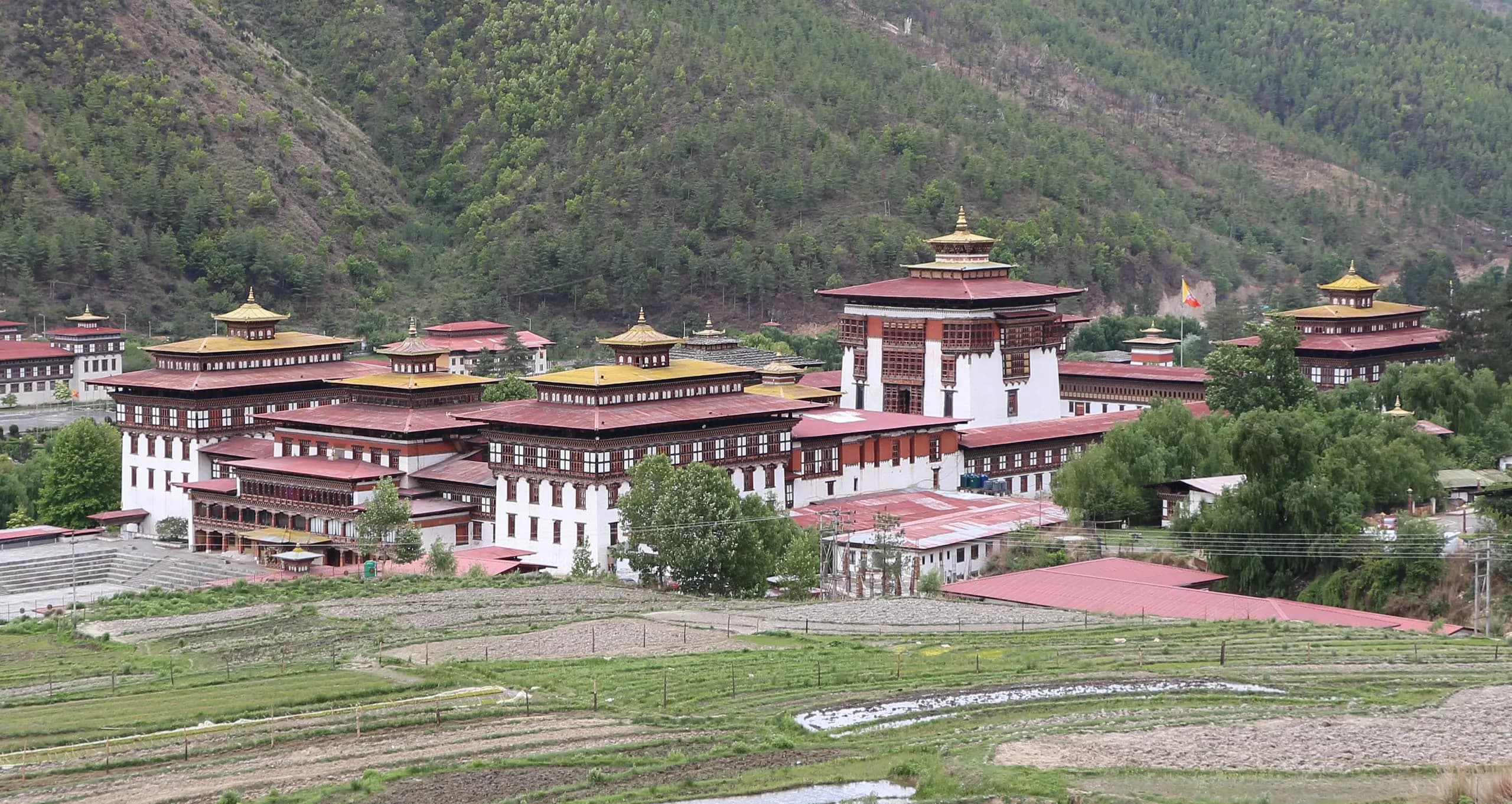 MonumentTashichho Dzong — the fortress of the auspicious religion, at the heart of Thimphu.Tashichho Dzong — the seat of Bhutan's central government and Je Khenpo summer residence in Thimphu. History, architecture, visiting.
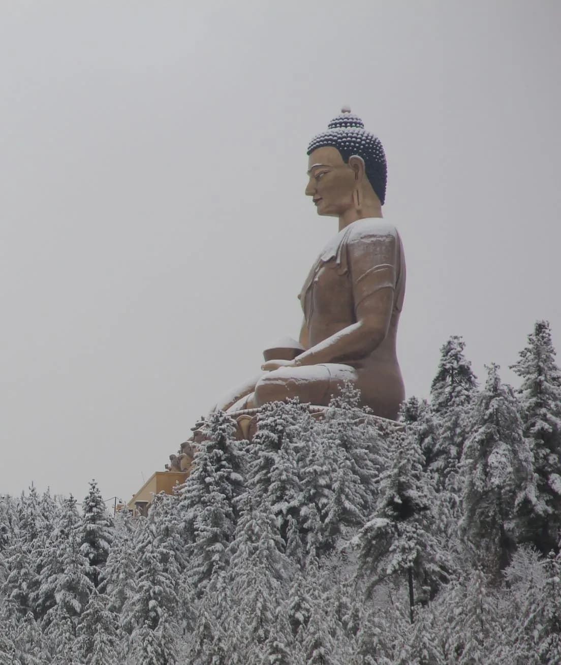 MonumentBuddha Dordenma — the great gold-plated Shakyamuni, fulfilling an 8th-century prophecy of Guru Rinpoche.Buddha Dordenma — the 51.5-metre seated Buddha above Thimphu. The prophecy, the construction, the 125,000 smaller Buddhas inside. Visiting.
Festivals nearby
Journeys around this hike
Frequently asked
- How fast has the Druk Path been run?
- Our operator team has completed the route as a single-day push multiple times — the fastest internal time stands at 7 hours. Serious athletes with prior mountain ultra experience and proper altitude acclimatisation can reasonably target 7-10 hours of total elapsed time; elite mountain-ultra runners are likely capable of substantially faster. The route is not yet a publicly-timed event.
- Can I attempt the Druk Path Run as my first mountain ultra?
- No. We require a serious prior mountain-ultra record — minimum a completed 50+ km mountain ultra with 3,000+ metres of vertical ascent within the previous two years, demonstrated time above 4,000 metres, and a recent aerobic-base assessment. The route's altitude and the support architecture are not appropriate for first-time ultra-distance runners; the bail-out infrastructure is real but limited.
- How does the Druk Path Run compare to other mountain ultras?
- By distance (60 km) it sits in the moderate-ultra range. By altitude (sustained 3,500-4,200m, with the run's middle 30 km above 3,800m) it sits at the demanding end. By technical terrain it is moderate — the trail is well-defined throughout, with no exposure or scrambling. By organisational depth it is a private-operator product rather than a public race — small cohort, full support, no race-day crowd. The closest international comparable is, in our view, the high-altitude sections of the Lavaredo Ultra Trail or the Tor des Géants, but at lower technical difficulty and higher sustained altitude.
- What if I cannot finish?
- We bail you out. Withdrawal during the opening climb means a short descent to Phajoding (4 km from Motithang, vehicle-accessible from Thimphu). Withdrawal in the middle ridge section between Simkota Tsho and Jele Dzong means a longer trek-out on foot with the support crew. Withdrawal in the final descent means continuing the final kilometres on foot or a wait for the vehicle from the Ta Dzong side. Helicopter evacuation from the Jimilang Tsho ridge is available in clear weather as a safety backup. Bail decisions are honoured without judgement; the run is demanding and unfinished attempts remain a substantial Himalayan experience.
- Why these four months?
- Late May, June, October, and November all work. The pre-monsoon May-June window catches spring rhododendron on the lower trail and clear post-winter Himalayan visibility from the ridge; the post-monsoon October-November window catches autumn clarity and the most-stable conditions across the high passages. The monsoon months (July-September) make the meadow trail wet and the high ridge cloud-bound. The winter months (December-April) carry snow on the upper passages that makes the single-day push unsafe.
- Can I run the Druk Path Run unguided?
- Not under the Royal Government's current tourism framework. International visitors in Bhutan must be accompanied by a licensed Bhutanese guide for all multi-hour outdoor activity above 3,000 metres; the Druk Path Run sits squarely in this category. The guided format is also, in our direct experience of the route, the only safe way to attempt it — the support architecture is what makes the single-day push possible.