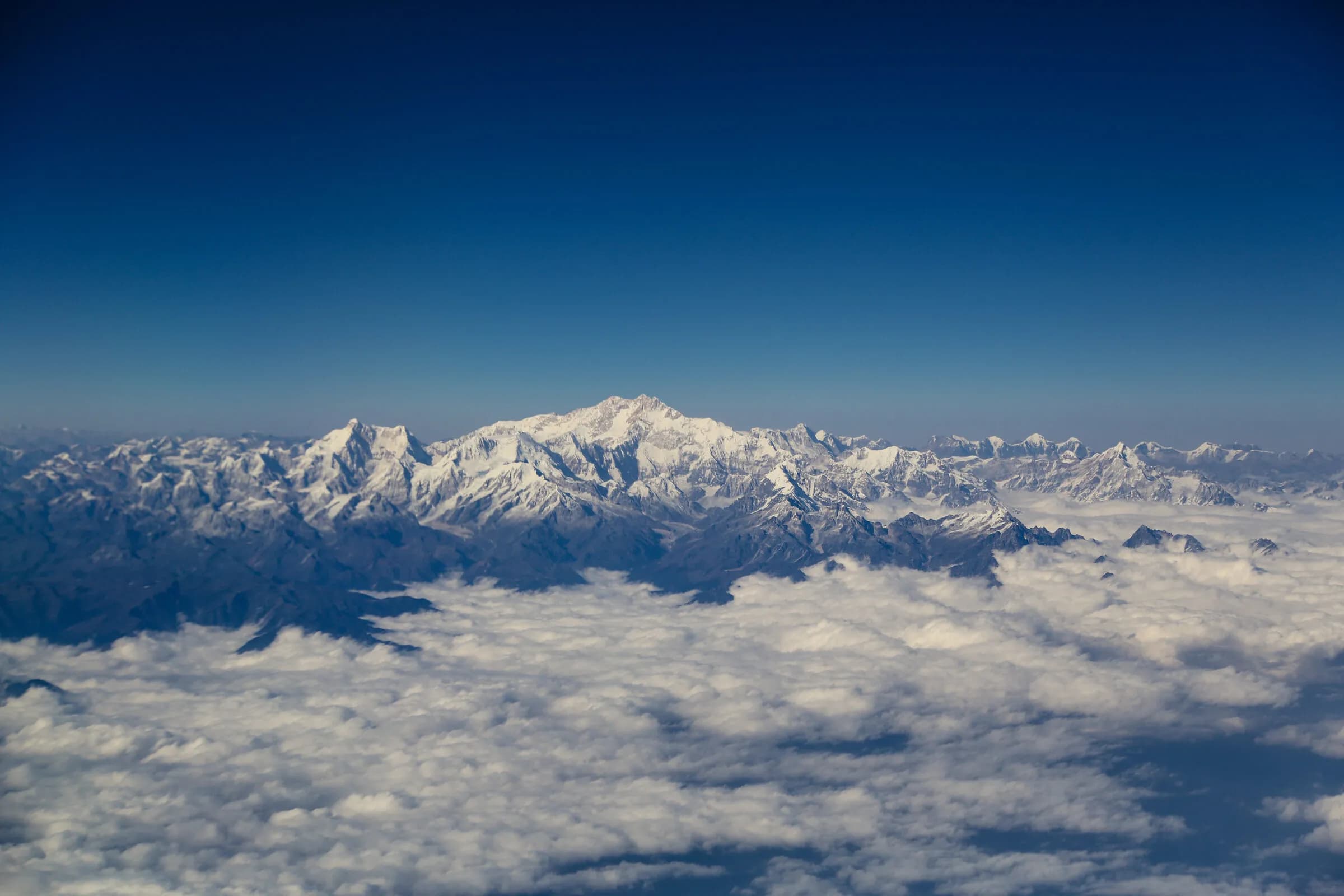
Bhutan's signature multi-day trek
Chomolhari Lingshi Trek — six days, max altitude 4,900 m at Bonte La, the principal direct view of Chomolhari (7,326 m).
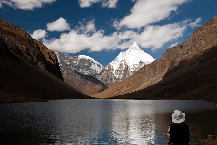
The Chomolhari Lingshi Trek (also called the Chomolhari-Lingshi-Thimphu route) is Bhutan's signature multi-day trek — six days from Shana at the head of the Paro valley (a 1-hour drive from Drukgyel Dzong on the now-motorable road), climbing to the Jangothang base camp directly beneath Chomolhari (7,326 m), continuing north across the high pasture country of Lingshi village, and exiting south over Bonte La to Barshong with vehicle pickup back to Thimphu. The trek pairs accessible difficulty with substantial Himalayan reward.
Also known as Jomolhari Trek (alternate spelling) · Chomolhari-Lingshi-Thimphu Trek · Chomolhari-Lingshi Trek
- Duration
- 6 days
- Max altitude
- 4,900 m
- Difficulty
- strenuous
- Distance
- 103 km
- Region
- Paro, Thimphu
- Trailhead
- Shana, upper Paro valley (2,870 m) — driven to from Drukgyel Dzong on the now-motorable road, approximately 1 hour
- Trail end
- Barshong (3,710 m) — vehicle pickup, drive back to Thimphu or Paro
- Best months
- April · May · September · October
- Walk type
- trek
The route, in brief
The trek begins at Shana in the upper Paro valley (driven from Drukgyel Dzong on the motorable road, approximately 1 hour), climbs the Pa Chhu through Thangthangkha to reach the Jangothang base camp at 4,080 metres — directly beneath the south face of Chomolhari. After a rest day at Jangothang, the trek continues north over Nyile La (4,890m) into the Lingshi yak-pasture country, then south via Shodu, over Bonte La (4,900m), and exits at Barshong with vehicle pickup. Six trekking days total; the high passes Nyile La and Bonte La carry the principal altitude challenge.
The mountain — Chomolhari and the Bhutanese tradition
Chomolhari (the Bhutanese canonical name; 7,326 m) is the principal sacred mountain of the upper Paro valley — the abode of the goddess Aum Jomo, the female protector deity of the Bhutanese state. The mountain has been climbed by mountaineers only twice (1937 by Spencer Chapman and Pasang Dawa Lama via the Bhutanese south face; 1970 by an Indian-Bhutanese joint expedition), and Bhutanese climbing of all peaks above 6,000 metres has been formally prohibited since 1994 in deference to the Bhutanese view of the high peaks as the abodes of protector deities. The Jangothang base camp at the foot of the south face is the closest direct approach permitted under the current Royal Government policy.
Difficulty, season, and the realistic profile
The trek is strenuous but accessible — the difficulty is in the altitude (multiple days above 4,000m, max altitude 4,900m at Bonte La) rather than the terrain itself (the trail is well-defined and the gradient is moderate). Pre-trek conditioning over 2–3 months is the standard preparation; a reasonably-fit walker with prior multi-day trekking experience (any 4+ day trek above 3,000m) is the realistic profile. The two principal seasons are April-May (the spring window with rhododendron in bloom on the lower trail) and September-October (the autumn window with the clearest mountain views). June-August is monsoon; November-March the high passes are snow-affected.
Day by day
- Day 1
Shana to Thangthangkha
3,610 m · 22 km · 8 h walking
Driven from Drukgyel Dzong to Shana on the motorable road (approximately 1 hour). Climb through pine and rhododendron forest along the Pa Chhu to the alpine meadow at Thangthangkha — the first camp.
- Day 2
Thangthangkha to Jangothang
4,080 m · 19 km · 6 h walking
Continued climb up the Pa Chhu valley to the Jangothang base camp at the foot of Chomolhari's south face. The first full view of the mountain.
- Day 3
Jangothang — acclimatisation day
4,080 m · 6 km · 4 h walking
Rest day at the base camp. Acclimatisation walks to the Tsophu lakes or up the Chomolhari ridge for the broader panorama.
- Day 4
Jangothang to Lingshi via Nyile La
4,890 m · 18 km · 8 h walking
Climb Nyile La (4,890m), the trek's first high pass. Descend to Lingshi village in the high pasture country; the Lingshi Dzong above the village is the visual register of the day.
- Day 5
Lingshi to Shodu
4,080 m · 22 km · 9 h walking
Long traverse of the high pasture country with Lingshi Dzong views; descent to the Shodu camp.
- Day 6
Shodu to Barshong via Bonte La
4,900 m · 16 km · 8 h walking
Cross Bonte La (4,900m), the trek's highest pass and the second principal altitude challenge. Long descent through alpine pasture to Barshong; vehicle pickup for the drive to Thimphu or Paro.
Before you go
- Season
- Two windows. April-May catches the spring rhododendron bloom on the lower trail and clear pre-monsoon mountain views. September-October catches the autumn clear-sky window with the most-reliable Chomolhari visibility. November-March the high passes are snow-affected and the trek cannot be safely attempted; June-August is monsoon.
- Fitness
- Strenuous but accessible. Six trekking days averaging around 17 km on active days; max altitude 4,900m at Bonte La (Day 6). A reasonably-fit walker with prior multi-day trekking experience (any 4+ day trek above 3,000m) is the realistic profile. Pre-trek conditioning over 2–3 months is the standard preparation. The altitude — not the terrain — is the principal challenge.
- Crew and accommodation
- Camp-based trekking with a porter-and-yak crew, cook team, and trek leader. Insulated tent camps with proper kit; hot food at every camp. No lodge-based variants exist on this route.
- Adjacent routes
- The first three to four days of the Chomolhari Trek (Shana → Thangthangkha → Jangothang → Nyile La → Lingshi) are shared with the Snowman Trek and the Chomolhari-Laya-Gasa Trek. The Chomolhari Trek diverges south from Lingshi via Shodu and Bonte La to exit at Barshong; the Snowman and Laya-Gasa routes continue north into the Layap and Lunana valleys.
Monuments on the route
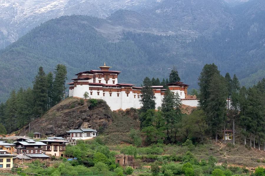 MonumentDrukgyel Dzong — the 1649 victory fortress, ruined by fire in 1951, under restoration since 2016.Drukgyel Dzong — the 1649 Bhutanese victory fortress, ruined by fire 1951, under restoration. The Chomolhari panorama and visiting.
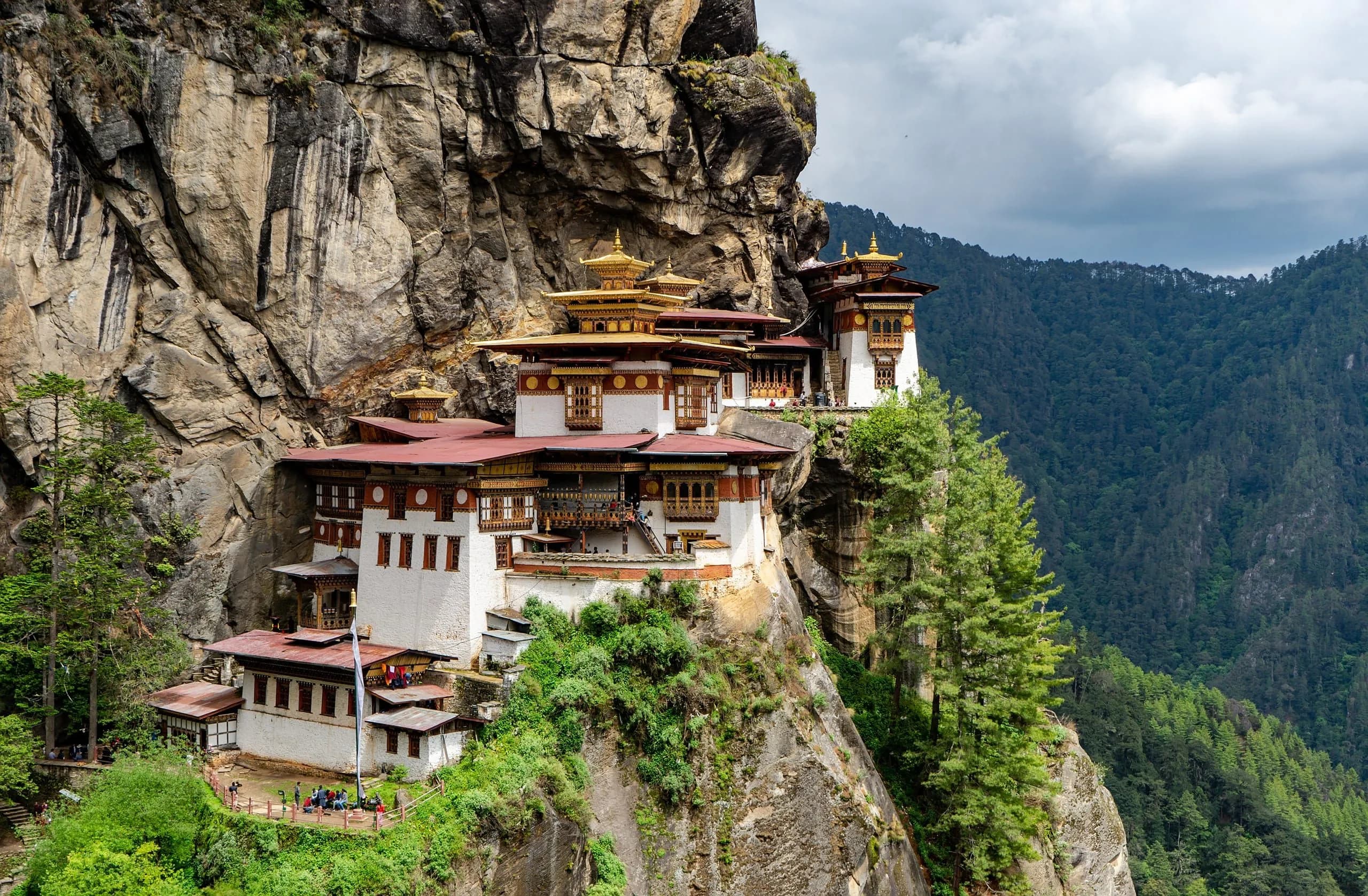 MonumentParo Taktsang — Guru Rinpoche's meditation cave, perched at 3,120 metres on the cliff above the Paro valley.Paro Taktsang (Tiger's Nest) — the founding by Guru Rinpoche, the 1692 monastery, the 2-hour hike, what to know before you visit.
Journeys around this trek
- JourneyThe Chomolhari Base Camp trek, paced for the autumn window.A fourteen-night Bhutan Chomolhari Trek itinerary in the autumn clear-sky window. Five days at altitude, premium lodges either side, named trekking guides.
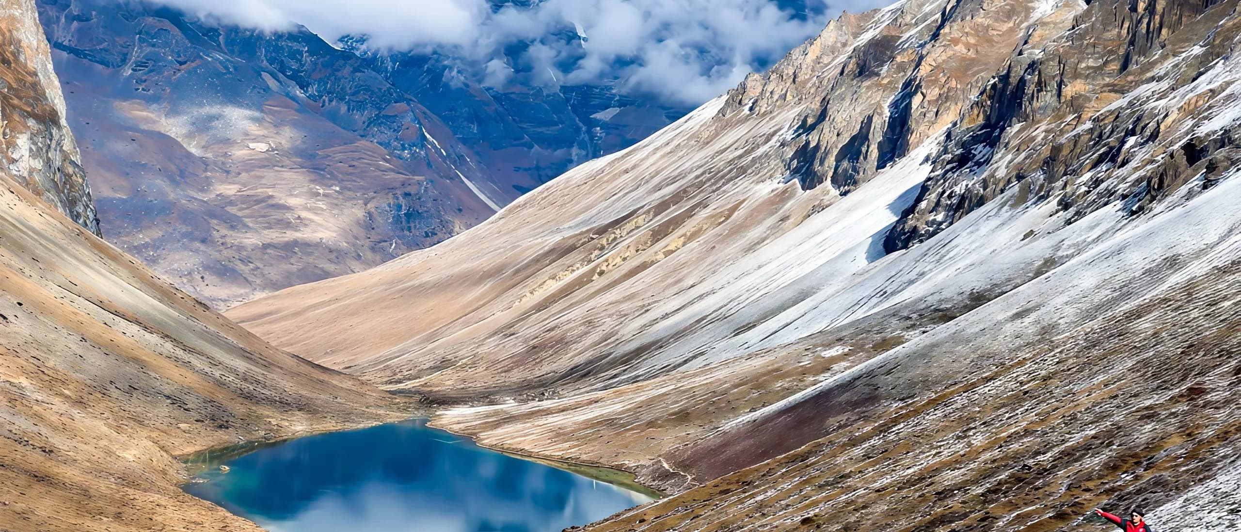 JourneyFourteen nights for the Chomolhari Trek — the Bhutanese alternative to Annapurna.A fourteen-night Bhutan Chomolhari Trek itinerary positioned as the Bhutanese alternative to Nepal's Annapurna Base Camp or Annapurna Circuit. Substantially less crowded.
Frequently asked
- Will I see Chomolhari?
- Yes — the Jangothang base camp (Day 2 onwards) provides the most direct view of Chomolhari (7,326 m) accessible to non-mountaineers. Weather visibility is most reliable in April-May and September-October. The first full view from Thangthangkha (Day 1 evening) is itself notable.
- How is the Chomolhari Trek different from the Snowman?
- The Chomolhari Trek is 6 days; the Snowman is 25. Both share the first 3-4 days (Shana → Jangothang → Lingshi). The Snowman continues north into Lunana with eleven passes above 4,500m; the Chomolhari turns south at Lingshi via Shodu and Bonte La to exit at Barshong. The Chomolhari is accessible to most reasonably-fit walkers with multi-day trekking experience; the Snowman is an expedition product.
- Can I climb Chomolhari?
- No. The Royal Government has formally prohibited climbing of all Bhutanese peaks above 6,000 metres since 1994, in deference to the Bhutanese view of high peaks as abodes of protector deities. The Jangothang base camp is the closest direct approach permitted under the current Royal Government policy. The trek itself is the principal Chomolhari experience available.
- What about Aum Jomo?
- Aum Jomo is the female protector deity held to reside in Chomolhari — the most-revered of the regional protector deities in the upper Paro valley. The Bhutanese trekking tradition holds that a brief offering at the Jangothang camp (a butter lamp, a quiet prayer) acknowledges the deity's hospitality and the trekker's status as a guest in the mountain's region. Your trek leader will brief you on the protocol; the gesture is meaningful in the Bhutanese register.
- Lodges or camp?
- Camp only. No lodge-based variants exist on this route. The premium operators provide insulated tent camps with expedition-grade kit, hot food at every camp, and a crew that handles all camp logistics. Camp life on the Chomolhari Trek is more comfortable than many first-time trekkers expect.